
Public beta · Made in Sydney
The best road is never the fastest one.
Moto Maps picks roads the way you do — by the corners, not the clock.
In your browser
No app store
No sign-up to start
Moto Maps picks roads the way you do — by the corners, not the clock.
Same start. Same finish. Turn/km is how much cornering a road actually gives you.
The parts of a ride a car map gets wrong — and a rider pays for.
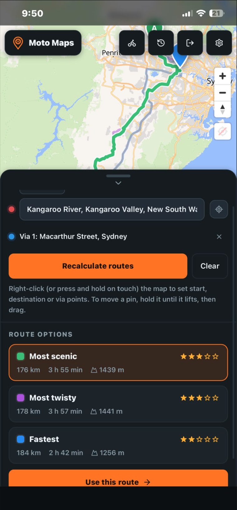
Scenic, twisty, fast — scored on real road geometry: corners per kilometre, elevation, and how much of it is single carriageway. Drag any line to reshape it. Drop a via point anywhere.
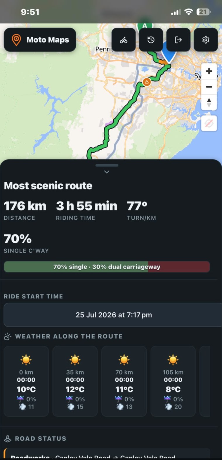
Not the forecast at home right now — each point along the route is timed to when you'll actually reach it. See the shower waiting two hours out, and pick a different day.
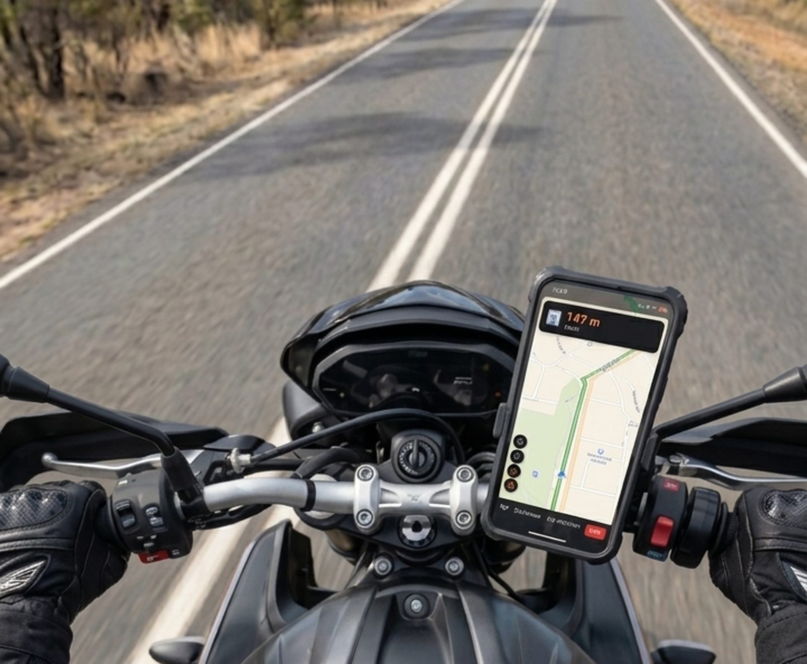
Voice guidance, screen stays awake, first-person view. Miss a turn and it routes you to the nearest point back on your road — never all the way to the start. Hit a closure and it hands you a short detour that keeps you on the road you picked.

Everyone on one live map. Strongest in NSW, where we started.
Everyone in the group, moving, in real time.
Someone suggests a café or servo on the shared stretch. It's only set once every rider says yes. No twelve-message group chat.
Police, gravel, roadworks — dropped by whoever sees them first.
Location is the most sensitive thing an app can hold. Here's the deal.
Riders see your bike and marker. Never your real name.
Position shares to your group during a ride, and stops when it ends.
A safety link works only for whoever holds it. Nobody can look you up.
Maps come from OpenStreetMap. There's nothing to sell about you.
Everything's free through 2026. Paid plans arrive in 2027 — you'll know well before.
Add it to your home screen — full screen, own icon, ten seconds, nothing to download.
An 18-page guide with real screenshots: planning a multi-stop day, reading the route scores, fuel planning, the drive screen, group rides, sharing, and an honest list of what it can't do. Free, no sign-up.
It runs in your browser, so there's nothing to download and it's always the latest version. Add it to your home screen and it looks and works like any app. An Android version may land on Google Play later — for now, the link is the app.
Yes. Routing, maps, weather and navigation work anywhere. The one thing that's thin outside NSW right now is matching with riders you don't know — that needs riders nearby. Riding in a group with people you already know works anywhere.
Not yet, and we'd rather say so. Offline maps are the most-asked-for feature and they're in the works. For now, plan before you leave and export a GPX as backup.
It's measured, not guessed. We add up the road's actual heading changes and divide by distance. A road at 200°/km gives roughly three times the cornering of one at 65°/km. What it can't tell you is surface or how a corner feels at speed — that's your call.
A rider in Western Sydney who got tired of Google Maps sending him down the motorway. It's a real product in active development — and a beta, so if something's broken, telling us actually helps.
No download, no sign-up. Drop a start and a finish, and look at the three lines.
Open the map